Understanding where the founding families of this region lived can be extremely tricky. The Conococheague Institute actually straddles two 18th Century Davis families' properties (Philip on the south side, John on the north).
As the original lands were divided by sons and sold off it gets harder and harder to envision these areas from the modern perspective.
Historical Societies and Antiquaries have been diligent over the ages in preserving these deeds in books and maps which allows us to continue to treasure our Cultural Heritage.
Thanks to the work of Volunteer Barry Elliott of Greencastle, a project has begun to map these Early Franklin County land surveys digitally using Google Earth.
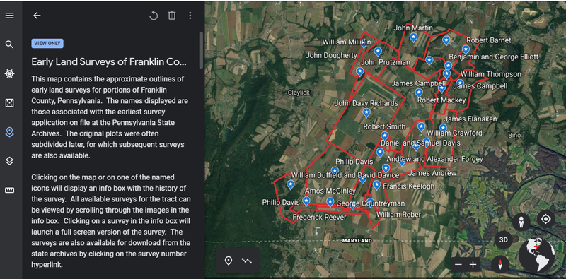
Click the link below to start exploring the old frontier!
(hold down the Ctrl key when clicking to open a link in a new browser tab)
From villages to townships, and counties to states, we are all linked together by a common bond.
In continuing with his digital survey project, Barry Elliott visited every courthouse in PA, recording each one in photography and mapping across the entire state each county boundary.
Combined with the Land survey's project he did on the local settlers it links us to the larger Pennsylvania stories.
Courthouses are also one of the often overlooked buildings. In modern towns they can be missed, but they are an expression of the county they represent and are noticeable for their architectural opulence and splendor
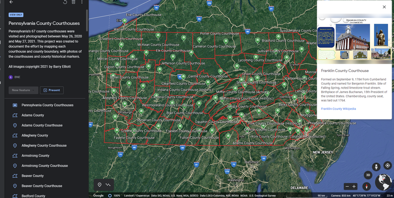
Click the link below to start exploring: